|
|
|
|
|
|
|
|
|
|
|
|
High
Winds
and Hard
Hits:
East
Detroit
Face-to-Face
with
EF-1
Tornado,
Severe
Storm
Damage
Jean
Davis -
Local/State
Tell Us
Detroit
News
Bureau
DETROIT
-
Emergency
crews
and DTE
Energy
workers
are
assessing
damage
across
Detroit’s
east
side
this
morning
after a
fast-moving,
severe
thunderstorm
spawned
a
tornado
late
Thursday
afternoon.
The
tornado
touched
down
shortly
after
5:15
p.m. on
Thursday,
September
3. Radar
velocity
data and
ground
damage
reports
indicate
the
rotation
developed
rapidly
along
the
Jefferson
Avenue
corridor
before
tracking
northeast
toward
the
English
Village
and
MorningSide
neighborhoods.
The
preliminary
report
classifies
the
event as
a brief
EF-1
tornado,
with
peak
wind
gusts
estimated
between
90 and
100 mph.
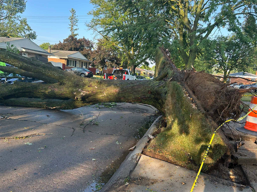
The
storm
left
structural
damage
and
heavy
debris
in its
wake.
Dozens
of
mature
trees
were
uprooted
or
snapped,
taking
down
overhead
power
lines
along
major
arteries
including
Warren
Avenue
and Mack
Avenue.
Multiple
residential
properties
sustained
roof
damage,
collapsed
porches,
and
broken
windows
from
flying
debris.
Several
commercial
structures
along
Gratiot
Avenue
reported
blown-out
storefront
glass
and
minor
facade
damage.
DTE
Energy
reports
that
over
22,000
customers
on the
city's
east
side
lost
power
during
the
height
of the
storm.
Service
crews
have
been
deployed
to clear
fallen
lines
and
begin
line
repairs.
Detroit
Fire
Department
and
emergency
services
responded
to
dozens
of
emergency
calls
involving
downed
wires
and
blocked
roadways
immediately
following
the
touchdown.
City
officials
confirmed
that
while
several
individuals
received
minor
injuries
from
shattered
glass
and
debris,
no
severe
injuries
or
fatalities
have
been
reported.
City
crews
are
prioritizing
the
clearance
of main
thoroughfares
to allow
emergency
access.
Residents
in
affected
areas
are
urged to
treat
all
downed
power
lines as
energized
and
maintain
a
distance
of at
least 20
feet,
avoid
driving
through
neighborhoods
with
high
concentrations
of
fallen
tree
limbs
and
damaged
utility
poles,
and
report
structural
hazards
or
blocked
streets
to local
authorities.
The
National
Weather
Service
is
expected
to
release
a
detailed
damage
survey
report
later
today
outlining
the
precise
path
length
and
official
peak
intensity.
According
to
initial
assessments
from the
National
Weather
Service,
another
round of
thunderstorms
will
move
into the
area
early
this
morning
and may
persist
into the
early
afternoon,
with a
chance
some
storms
may
become
severe
with
hail and
gusty
winds
occurring
in
multicell
clusters
or
broken
lines
moving
northwest
to
southeast
at 30
knots.
|
|
|
|
|
|
|
|
|




 I
HI TECH NEWS
I
SPORTS
I
I
HI TECH NEWS
I
SPORTS
I